Site Location and Context
The site extents to around 11.28ha, and is located approximately 1.5km northeast of the centre of Stenhousemuir on the south side of Bellsdyke Road (A88).
The land is currently a single field of shallow sloping farmland. Existing boundaries are largely comprised of existing hedgerows, and post and wire fences. Beyond the site to the south and east is farmland. This land is designated as Green Belt in the LDP2. The layout of the proposal will be designed to form an appropriate inner Green Belt boundary to Stenhousemuir.
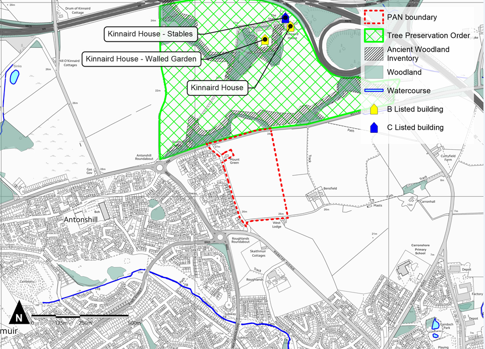
Kinnaird House and its estate is located to the north of the site, on the northern side of Bellsdyke Road. The estate extends north to the M9 motorway.
This estate comprises areas of farmland and woodland. A Tree Preservation Order (TPO) covers the entirety of the Kinnaird House estate. Most of the woodland is also identified in Nature Scot’s Ancient Woodland Inventory as Long Established Woodland of Plantation Origin.
Kinnaird House and its associated Walled Garden are identified as B Listed buildings and the stables are identified as C Listed.
Through an appropriate design response, the proposal will ensure no adverse impacts on Kinnaird House or its estate. This will be confirmed through assessment work undertaken as part of the application process.
The mature woodland of the estate, screens the site in views from the north and helps define the northern site boundary.