Site Appraisal
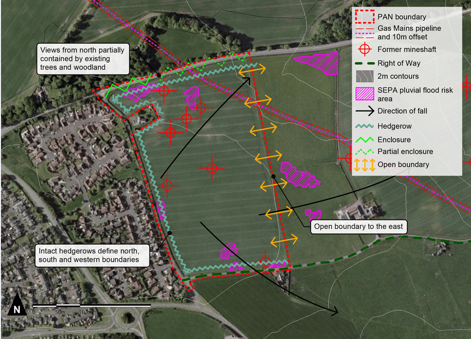
Initial site analysis has been undertaken. This has highlighted the following opportunities and constraints:- The site generally falls from west to east and is relatively flat.
- The site comprises arable farmland bounded by intact hedgerows along the north, south and western boundaries.
- The eastern boundary is defined by a post and wire fence, providing open views out to the countryside.
- A view from the site into the countryside is provided on the eastern boundary.
- Existing trees and woodland along the northern edge of Bellsdyke Road (A88) provide partial screening of the site in views from the north.
- Five former mineshafts are recorded within the site. Their exact locations will be confirmed through further investigation.
- A gas mains pipeline runs through the northeast corner of the site. The exact location will be confirmed through further investigation and a 10m buffer zone will be maintained.
- Small areas at risk of surface water flooding are identified in the northwest and southwest of the site. This will be mitigated as part of a detailed drainage strategy.
A series of technical assessments have been commissioned for the site and will inform the proposal once completed.