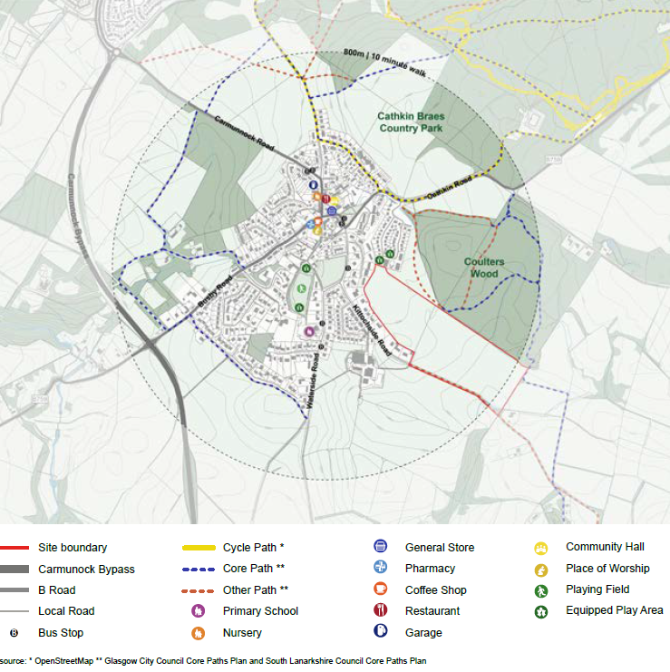
Site context
The site is located to the south-east of Carmunnock. The village of Carmunnock is entirely within the Glasgow City Council (GCC) area. The overall site does however cross the boundary between Glasgow and South Lanarkshire whereby the western area is within Glasgow and the eastern field is within South Lanarkshire.The village is located approximately 10km south of Glasgow city centre; 7km north of East Kilbride town centre and benefits from proximity to several districts within a closer proximity, including Castlemilk, Fernhill, Thorntonhall, Busby, Clarkston and Stamperland.
To the north of the site is a new residential development at Coulters Crescent, together with an equipped play area and a wildflower meadow. East of this (and to the north of the eastern part of the site) is Coulters Wood. These form robust edges to the boundary of the site. Kittochside Road forms the southern boundary of the site with agricultural land beyond to the south and east. Residential properties form the west and south boundaries to the western part of the site.