Site considerations
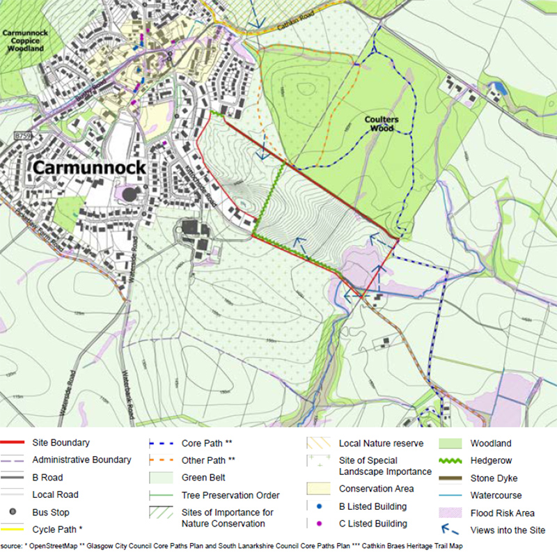
The site consists of a two agricultural fields, the western field extends to approximately 4.5ha and the eastern field extends to approximately 8.5ha.The highest point of the site sits at 165m AOD which is located towards the south east of the western field. The site drops to 155m AOD towards the north of the site; and 145m towards the south east.
There are two existing points of access via Kittochside Road.
A watercourse runs through the southern corner of the site with a small bridge crossing on Kittochside Road.
A stone dyke wall runs along the northern boundary of the site, separating the site from the Coulter Woods beyond.
A hedgerow runs in a north-south direction between the two fields and also in an east-west direction along Kittochside Road.
The boundaries between the site and the existing housing in the west and south comprise a mix of brick walls, hedgerows and tree planting.
Immediately adjacent to the north of the site is a path network which provides a circular walk-through Coulter Wood and onwards into the wider Cathkin Braes Countrypark beyond. The path network also runs along the southern boundary on Kittochside Road providing onward routes to the south-east.
Whilst the site is immediately adjacent to the settlement of Carmunnock, the Carmunnock Conservation Area is located slightly further to the west and is separated from the site by existing houses. There are no listed buildings within the immediate vicinity of the site.